
Localisation: United Kingdom
Coventry city council
Type of services
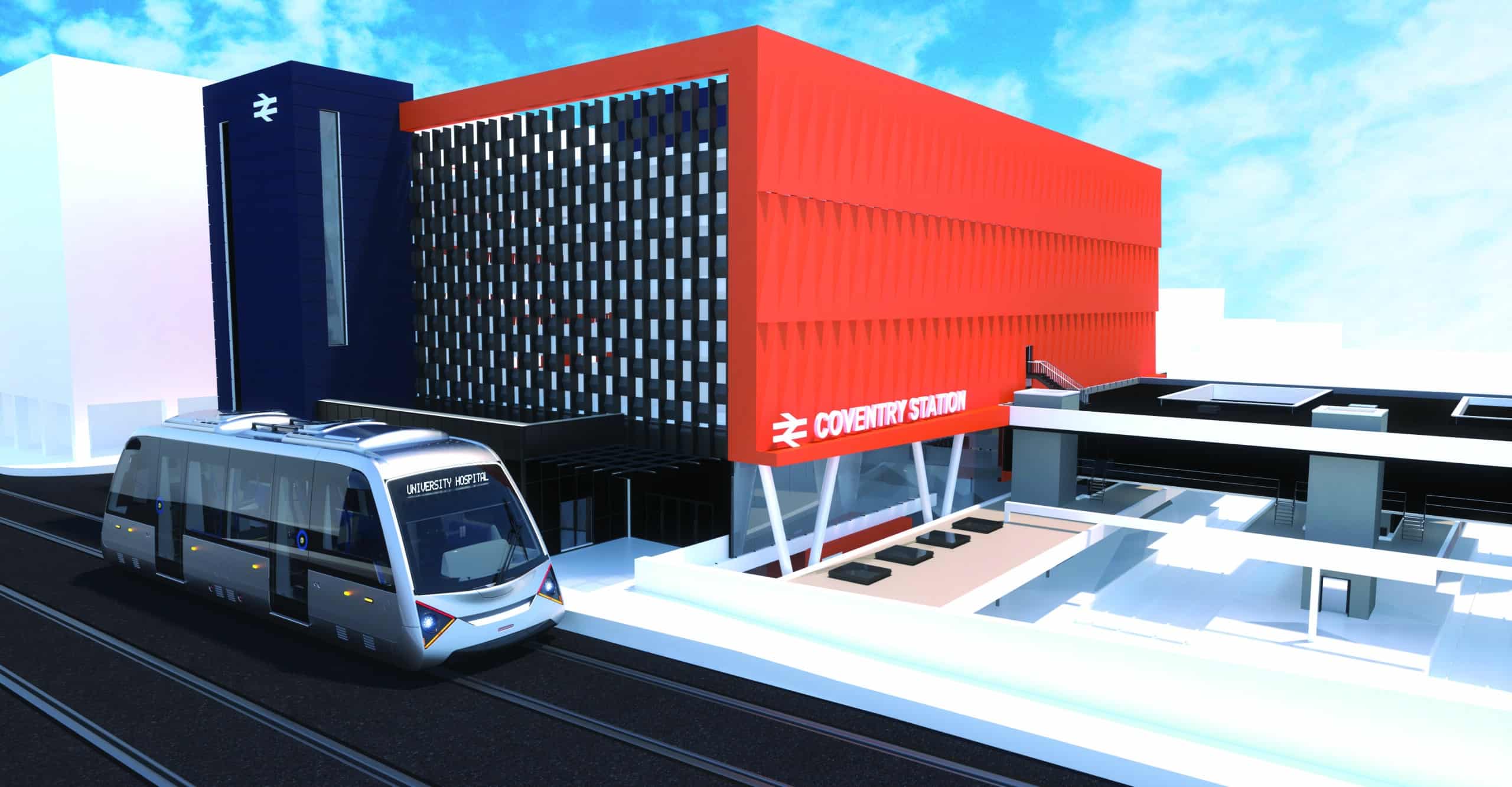
The Coventry Very Light Rail (VLR) project, led by Coventry City Council in collaboration with the University of Warwick, has appointed Ingerop as “innovative partner” to design a new type of tramline.
The project has the potential to revolutionize light rail systems all over the world, as VLR provides a new type of low weight rolling stock, allowing a fast and comfortable journey for all travelers.
Ingerop has developed a new type of track, easy and quick to install, largely prefabricated, which does not imply the reallocation of existing utilities networks (water, gas…), reducing significantly the cost and the construction time of the light rail projects for the cities.
WANT TO TAKE PART IN MAJOR PROJECTS? JOIN US!


Types of services
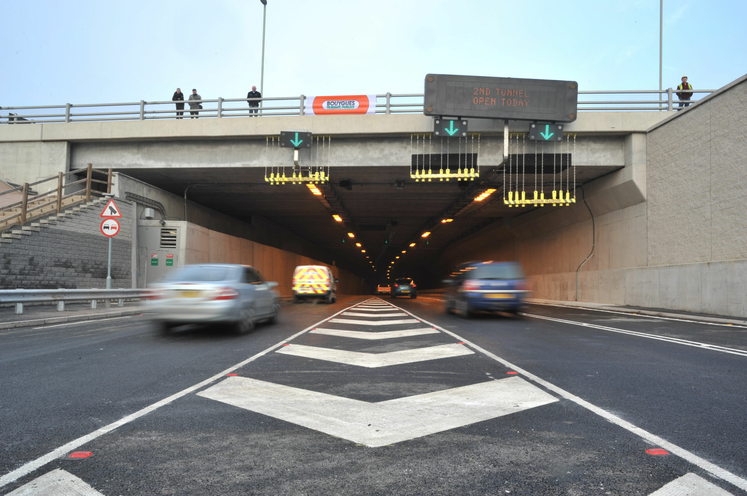
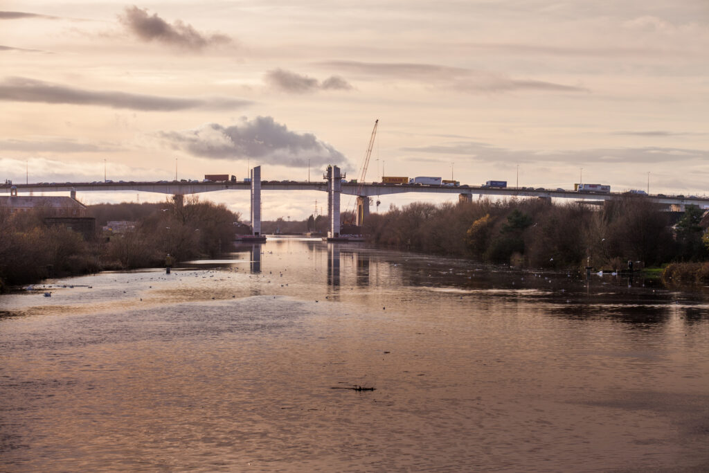
The Tyne Tunnels are located between the towns of Wallsend, in North Tyneside and Jarrow, in South Tyneside. In addition to the main tunnels and service buildings the site comprises a series of highway structures, including bridges, retaining walls, gantries, and lighting masts.
In 2007 Tyne Tunnels 2 (TT2), a single purpose, UK based, concession company was officially appointed as concessionaire for the New Tyne Crossing project. TT2 is responsible for the design, build, majority finance and operation of the new vehicle tunnel, the full refurbishment of the existing vehicle tunnel, and operation of all Tyne Tunnels until 2037.
The new immersed tube tunnel became operational in 2011, with all traffic being transferred into the new tunnel to enable the original vehicle tunnel to close to traffic for approximately ten months for refurbishment. The refurbished tunnel was commissioned in 2011 to carry all northbound traffic with the new tunnel carrying southbound traffic.
TT2 appointed Rendel to undertake the general and principal inspections of the tunnel and highway structures and the tunnel mechanical and electrical (M&E) equipment to Highway Agency Standards and the ongoing level monitoring of key structures. Rendel will also provide emergency response to assess any damage to the structures in the event of an incident. Rendel was appointed in 2012 for an initial seven year period, which was subsequently extended by a year, by the consortium of Bouygues Travaux Publics, HSBC Infrastructure Fund Management Ltd and Bank of Scotland Corporate which form TT2.
Rendel successfully completed the previous phase of the general and principal inspections of the Tyne Tunnel project (from 2012 to 2020). Rendel has been re-appointed to undertake the inspections and emergency response support initially for a second five-year period commencing in 2020 with a potential extension up to nine years, with each extension beyond the initial five-year team being on an annual basis.
Rendel is providing technical assistance to undertake the routine inspections of the structure and the M&E works for the structures, specifically:
- Structural inspections covering both civil and M&E elements in accordance with the DMRB BD63/07 Inspection of Highway structures and DMRB BD53/95 Inspection and Records for Road Tunnels
- Emergency/ad-hoc support on TT2 assets, including the road tunnels, bridges, retaining structures and gantries (referred to as the structures), external lighting, associated buildings
- Emergency support to provide timely expert structural advice and guidance regarding the condition of structures following an incident
- Monitoring of main tunnels using existing fixed indicators on an ongoing basis
- Review of the corrosion risks and requirements for the activation of a cathodic protection system
- Review and monitoring of safety-critical fixings
WANT TO TAKE PART IN MAJOR PROJECTS? JOIN US!

Type of services
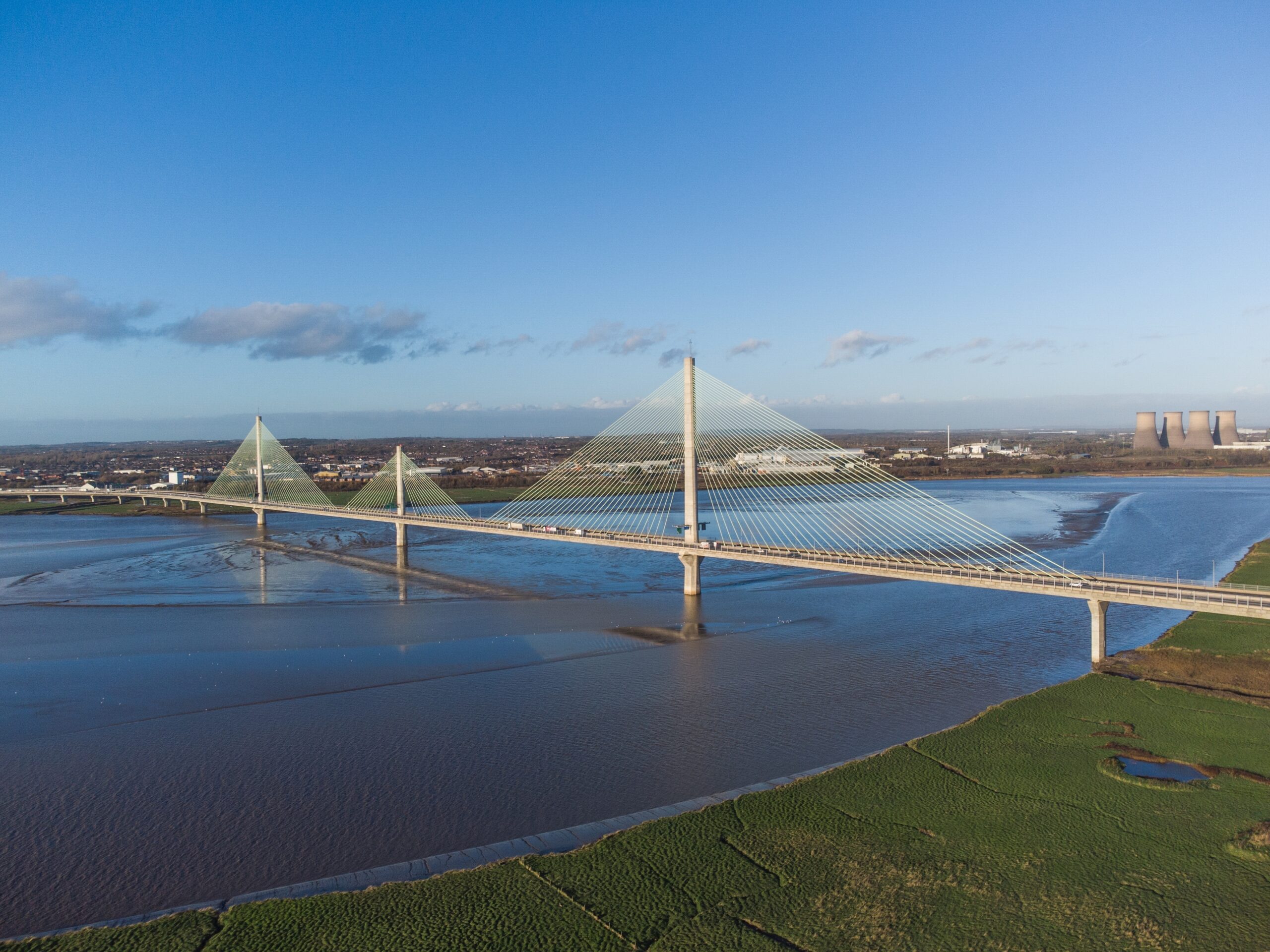
The Mersey Gateway Project was a major scheme to build a new six-lane, one-mile toll bridge over the Mersey between the towns of Runcorn and Widnes to relieve the congested and ageing Silver Jubilee Bridge. The new bridge crosses the Mersey about 1.5km east of the Silver Jubilee Bridge. It is a tolled crossing with a maximum speed limit of 60 mph.
Key elements of the project included:
- Plans to develop and integrate public transport, cycle and pedestrian links across Halton
- Plans to kick-start a major, 20-year, regeneration programme for Halton
- Improving regional transport links to encourage new and inward investment
- Road user charges on the existing Silver Jubilee Bridge between the two towns
The new bridge is over 70% funded by the private sector. By 2030 it will have created an estimated 4,640 new jobs through direct employment, regeneration activity and inward investment and generated an estimated £61.9m per annum in gross value added from the new jobs by 2030.
The Mersey Gateway Project forms the centrepiece of a new and improved high standard link road (9.5km long) connecting the national motorway network in north Cheshire with Merseyside.
Rendel was appointed as a member of the design JV, along with Ingerop and Atkins, to carry out the tender design of the main cable-stayed bridge and the approach viaducts, including the foundations. In addition, Rendel was also responsible for value engineering and the preparation of the bidding documents.
WANT TO TAKE PART IN MAJOR PROJECTS? JOIN US!

Type of services
One of the largest transport infrastructure projects in the UK at the time of construction.
The New Tyne Crossing was a privately financed scheme to design and build a 360m long immersed tube tunnel under the River Tyne in Newcastle between East Howdon on the north bank and Jarrow on the south bank. The project, delivered on a 30-year public/private partnership (PPP), includes a new 1.5km long tunnel comprised of the immersed tube tunnel with cut-and-cover tunnel approaches (total length 1,125m) and a major refurbishment of the 1967-built Tyne Tunnel. The new tunnel opened in February 2011, with the refurbished tunnel re-opening to traffic in November 2011.
The tunnel provided two traffic lanes in each direction and a three-fold increase in traffic capacity rating. The total length of the New Tyne Crossing project, including the approach roads, is approximately 2.6km, with a main carriageway typically 7.3m wide.
Rendel was the lead design consultant (supported by sub-consultants) for the detailed design of the civil works and coordination of the M&E works for the new tunnel and the refurbishment of the existing tunnel and approach roads, associated structures and buildings. The project included several kilometres of cut-and-cover approaches using D-walls and secant piles. The D-wall elements are some of the deepest ever carried out in the UK.
Rendel was also the lead design consultant for the preparation of the DBFO (Design, Build, Finance, Operate) tender design to the successful Bouygues-led consortium.
Rendel’s responsibilities included:
- Tender and detailed design of the new tunnel, highway works and bridge works
- Construction supervision and certification
- Refurbishment of the existing tunnel
- Managing regulatory approvals and consents
- The project won the 2012 British Construction Industry Award for Major Civil Engineering Project of the Year over £50m.
WANT TO TAKE PART IN MAJOR PROJECTS? JOIN US!

Queen’s Award 1985
The Constrado Structural Steel Design Award
Our services
Project overview
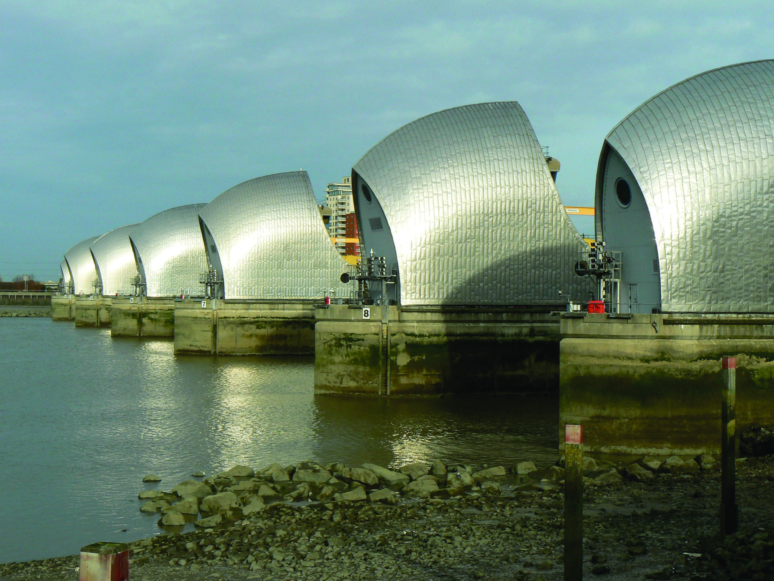
The Thames Barrier is one of the world’s largest and most prestigious moveable flood defence structures. It was designed by Rendel who also supervised the construction of one Europe’s largest civil engineering projects undertaken between 1975 and 1985. The Barrier protects London from North Sea surges which, when combined with high astronomic tides and heavy fluvial flows, could result in flooding over large areas to effectively take London out of action for up to six months.
The structure covers the entire width of the River Thames at Woolwich, with four primary openings of 61m to permit navigation and six subsidiary gated openings.
A novel feature is the 19m high, 3,400 tonne Rising Sector Gates (RSG’s) in the navigational openings, which lie in recessed sills in the river bed when not in use to allow unobstructed passage of river traffic through the Barrier. Each gate is pivoted and supported between concrete piers, which contain the operating machinery and control equipment, with primary controls located on the south bank.
All gates are designed to withstand a design surge differential head of 8.4m from the downstream side. When a flood threat is imminent, the gates are swung up through 90 degrees to a vertical position and form a continuous barrier across the river.
Rendel has been involved with the Thames Barrier since its inception in the 1960’s, and has been involved in the following aspects of its lifespan:
- Extension of life of barrier (originally 50 years but in 2009 increased to 120 years) combatting the dangers of climate change, potential increasing sea levels and the higher probability of tidal surges on London
- Extensive hydrological and tidal investigations, hydraulic and model studies
- Engineering design (including design of gates and operating machinery)
Rendel has provided detailed services including provision of advice with regards to analytical and physical investigations and preparation of focus documents provided to simplify and clarify the intended function of the barrier gates.
Further studies have included detailed finite element analysis of the structure to confirm areas of high stress concentrations using advanced computing techniques which were not available at the time the original design was carried out.
WANT TO TAKE PART IN MAJOR PROJECTS? JOIN US!
Types of services
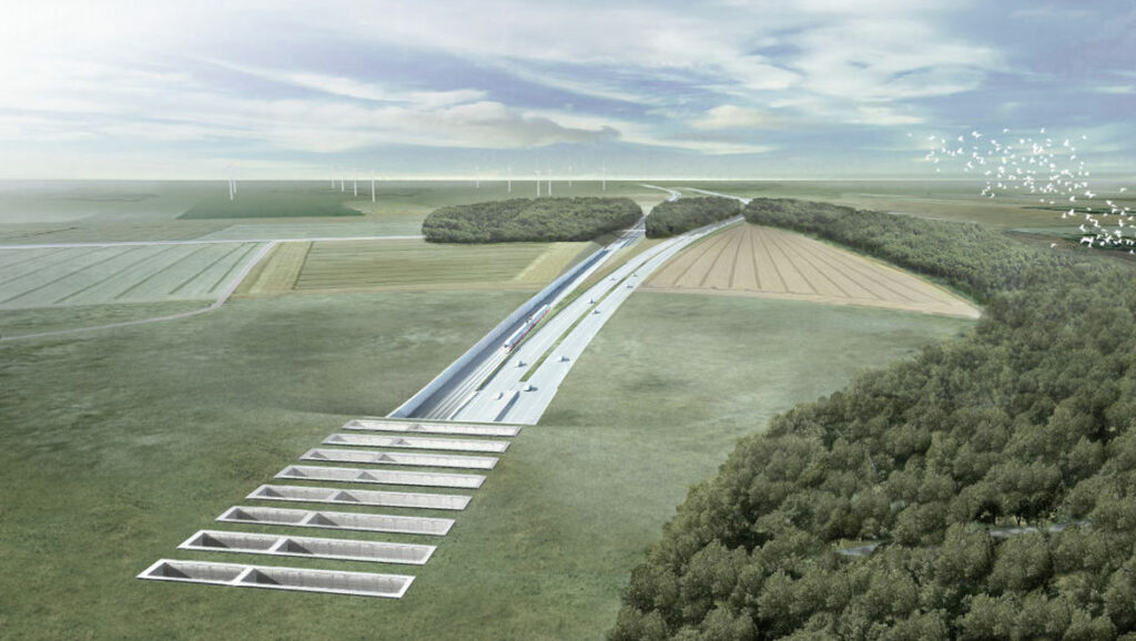
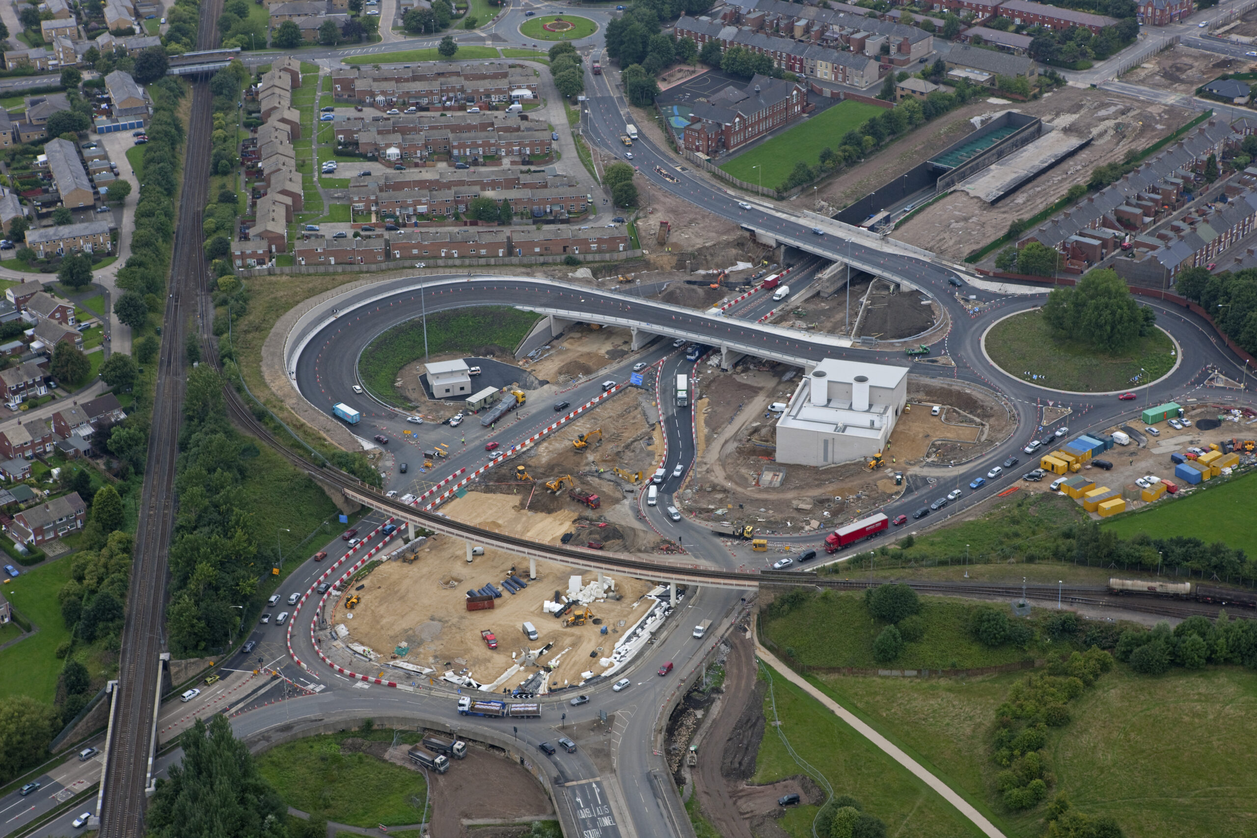
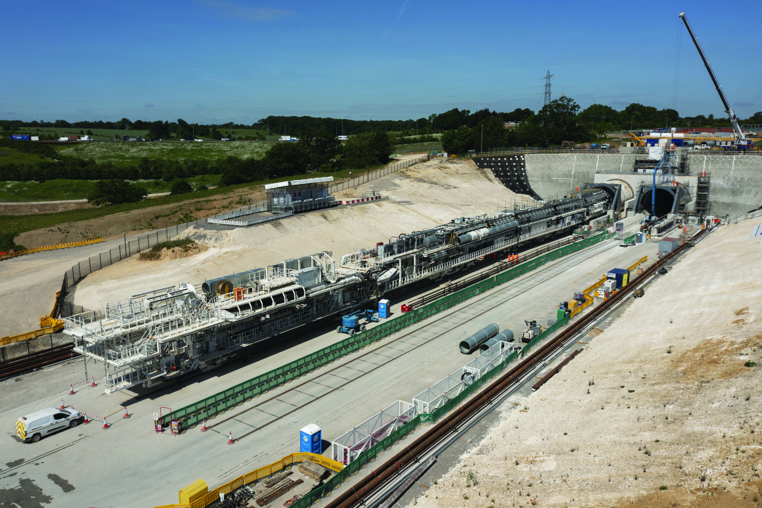
The Chilterns Tunnel is a 15.8km bored tunnel. There will be four vent shafts and one intervention shaft located along the proposed line of route – Chalfont St Peter, Chalfont St Giles, Amersham, Little Missenden and Chesham Road. Its southern portal is located near Maple Cross. Its site will also house a compound during construction with all material from the bored tunnel coming here to be treated prior to being used elsewhere along the line of route. The northern portal is adjacent to South Heath.
WANT TO TAKE PART IN MAJOR PROJECTS? JOIN US!
Types of services
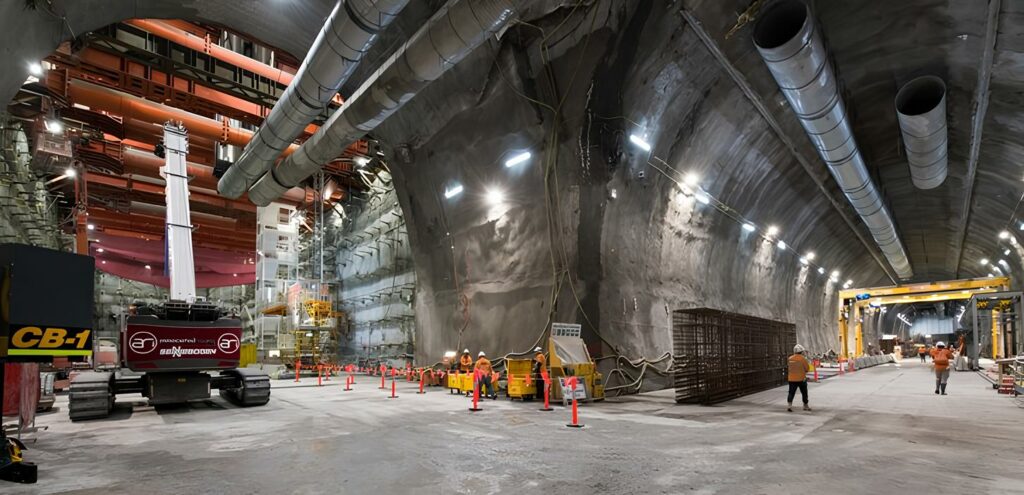
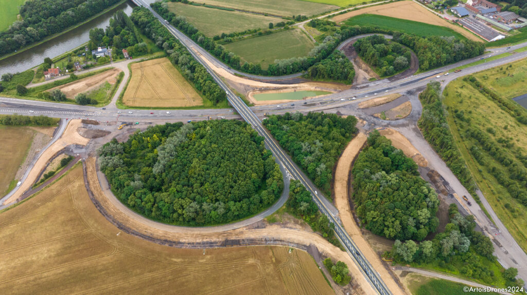
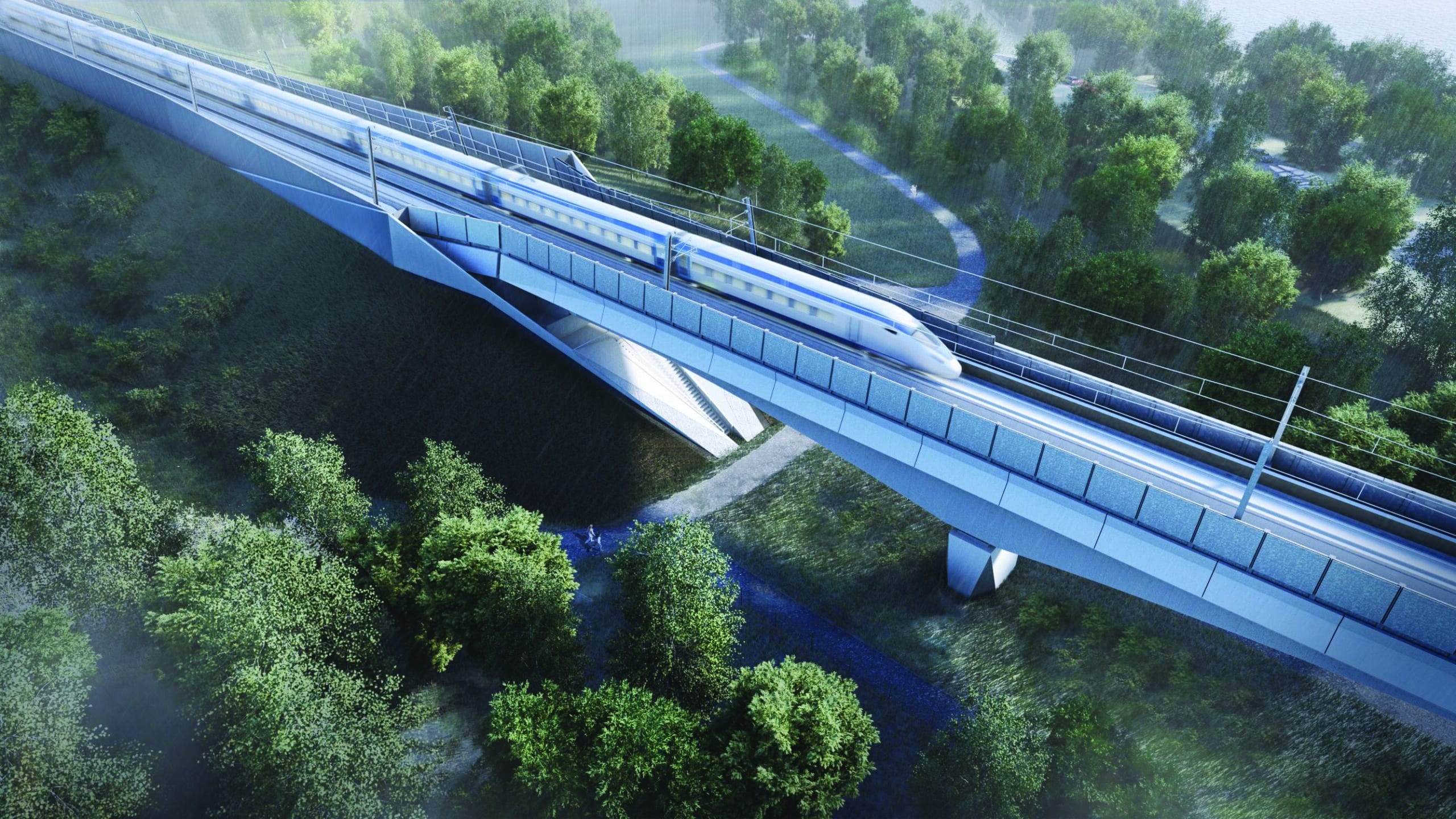
Rendel/Ingerop are responsible for developing and delivering the Scheme Design of the Civil Works in Stage 1 followed by the Detailed Design in Stage 2, for the Design-and-Build contractor, ALIGN. Align is comprised of the three Civil Contractors in Joint Venture (Bouygues Travaux Publics, Sir Robert McAlpine, Volkerstevin).
The services provided include design of the Colne Valley viaduct and other structural elements (e.g. abutments); design of associated approach embankments; geotechnical modelling, ground risk assessments and earthworks; soil-structure interaction analysis for piled foundations and earth-retaining structures; geological interpretation of GI data; development of ground models; highway designs for road diversions, realignments, new junctions, new access roads to compounds and transformer sites, highway scope definition, pavements, emergency hard standings, road drainage and vehicle swept path analysis; track alignments; production of 2D drawings and 3D BIM models of the designs to meet the ultimate client’s BIM and data management requirements; Environmental assessments; hydraulic modelling for river realignments / diversions; acoustic modelling for the design of Noise Barriers.