Type of services
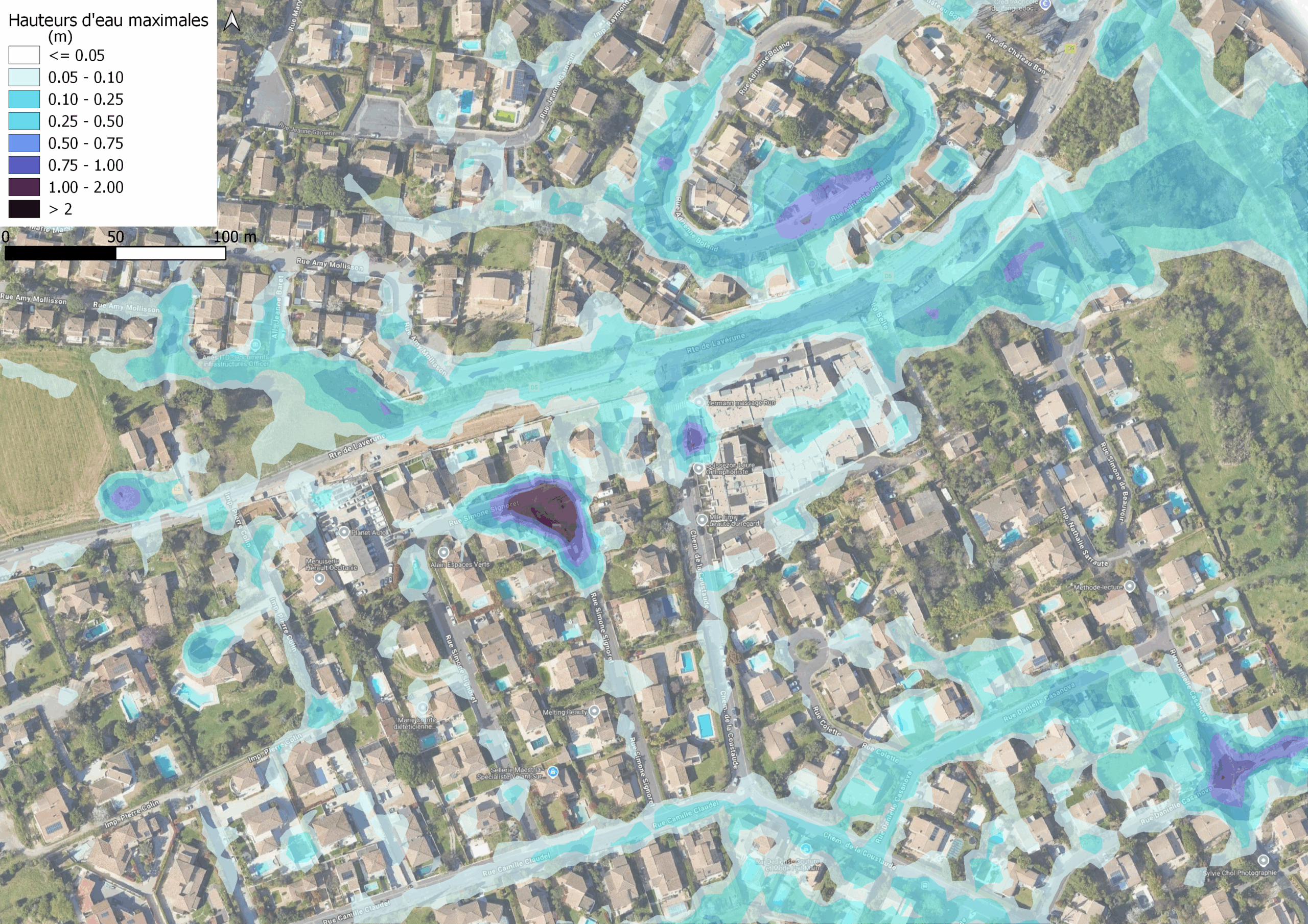
In order to improve knowledge of the risk of flooding due to rainwater run-off in the Montpellier Mediterranean Metropolis area, the aim of this project is to model flood-prone areas throughout the region.
It enables flood-prone areas to be characterised, flood hazards to be mapped and development solutions to be proposed. The results will be used to prepare the PLUi*, crisis management and vulnerability reduction. The study covers 860 km of hydrographic network, in both urban and natural environments. The 2D hydrological and hydraulic modelling is carried out by applying rainfall to the natural terrain survey and utilising high-definition LIDAR data (IGN). A detailed sensitivity analysis is conducted on test areas (grids, buildings, and small walls). The results will then be used to support crisis management.
*plui: intermunicipal local urban planning plan
